Project Description
Bolivia, officially the Plurinational State of Bolivia is a landlocked countrylocated in western-central South America. The constitutional capital is Sucre, while the seat of government and executive capital is La Paz. The largest city and principal industrial center is Santa Cruz de la Sierra, located on the Llanos Orientales(tropical lowlands), a mostly flat region in the east of the country.
Bolivia is located in the central zone of South America, between 57°26’–69°38’W and 9°38’–22°53’S. With an area of 1,098,581 square kilometres (424,164 sq mi), Bolivia is the world’s 28th-largest country, and the fifth largest country in South America, extending from the Central Andes through part of the Gran Chaco, Pantanal and as far as the Amazon. The geographic center of the country is the so-called Puerto Estrella (“Star Port”) on the Río Grande, in Ñuflo de Chávez Province, Santa Cruz Department.
The geography of the country exhibits a great variety of terrain and climates. Bolivia has a high level of biodiversity, considered one of the greatest in the world, as well as several ecoregions with ecological sub-units such as the Altiplano, tropical rainforests(including Amazon rainforest), dry valleys, and the Chiquitania, which is a tropical savanna. These areas feature enormous variations in altitude, from an elevation of 6,542 metres (21,463 ft) above sea level in Nevado Sajama to nearly 70 metres (230 ft) along the Paraguay River. Although a country of great geographic diversity, Bolivia has remained a landlocked country since the War of the Pacific. Puerto Suárez, San Matías and Puerto Quijarro are located in the Bolivian Pantanal.
Bolivia can be divided into three physiographic regions:
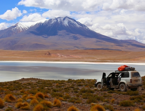
- The Andean region in the southwest spans 28% of the national territory, extending over 307,603 square kilometres (118,766 sq mi). This area is located above 3,000 metres (9,800 ft) altitude and is located between two big Andean chains, the Cordillera Occidental (“Western Range”) and the Cordillera Central (“Central Range”), with some of the highest spots in the Americas such as the Nevado Sajama, with an altitude of 6,542 metres (21,463 ft), and the Illimani, at 6,462 metres (21,201 ft). Also located in the Cordillera Central is Lake Titicaca, the highest commercially navigable lake in the world and the largest lake in South America; the lake is shared with Peru. Also in this region are the Altiplano and the Salar de Uyuni, which is the largest salt flat in the world and an important source of lithium.
- The Sub-Andean region in the center and south of the country is an intermediate region between the Altiplano and the eastern llanos (plain); this region comprises 13% of the territory of Bolivia, extending over 142,815 km2 (55,141 sq mi), and encompassing the Bolivian valleys and the Yungas region. It is distinguished by its farming activities and its temperate climate.
- The Llanos region in the northeast comprises 59% of the territory, with 648,163 km2 (250,257 sq mi). It is located to the north of the Cordillera Central and extends from the Andean foothills to the Paraguay River. It is a region of flat land and small plateaus, all covered by extensive rain forests containing enormous biodiversity. The region is below 400 metres (1,300 ft) above sea level.
Bolivia has three drainage basins:
- The first is the Amazon Basin, also called the North Basin (724,000 km2 (280,000 sq mi)/66% of the territory). The rivers of this basin generally have big meanders which form lakes such as Murillo Lake in Pando Department. The main Bolivian tributary to the Amazon basin is the Mamoré River, with a length of 2,000 km (1,200 mi) running north to the confluence with the Beni River, 1,113 km (692 mi) in length and the second most important river of the country. The Beni River, along with the Madeira River, forms the main tributary of the Amazon River. From east to west, the basin is formed by other important rivers, such as the Madre de Dios River, the Orthon River, the Abuna River, the Yata River, and the Guaporé River. The most important lakes are Rogaguado Lake, Rogagua Lake, and Jara Lake.
- The second is the Río de la Plata Basin, also called the South Basin (229,500 km2 (88,600 sq mi)/21% of the territory). The tributaries in this basin are in general less abundant than the ones forming the Amazon Basin. The Rio de la Plata Basin is mainly formed by the Paraguay River, Pilcomayo River, and Bermejo River. The most important lakes are Uberaba Lake and Mandioré Lake, both located in the Bolivian marshland.
- The third basin is the Central Basin, which is an endorheic basin (145,081 square kilometres (56,016 sq mi)/13% of the territory). The Altiplano has large numbers of lakes and rivers that do not run into any ocean because they are enclosed by the Andean mountains. The most important river is the Desaguadero River, with a length of 436 km (271 mi), the longest river of the Altiplano; it begins in Lake Titicaca and then runs in a southeast direction to Poopó Lake. The basin is then formed by Lake Titicaca, Lake Poopó, the Desaguadero River, and great salt flats, including the Salar de Uyuni and Coipasa Lake.


