


Project Description
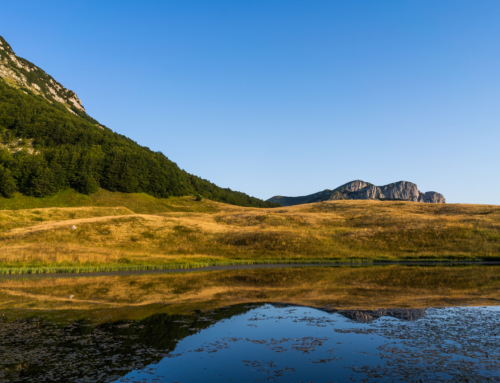
Bosnia and Herzegovina, is a country in South and Southeast Europe, located within the Balkans. Sarajevo is the capital and largest city. Bosnia and Herzegovina is not entirely a landlocked country as it may appear on a map – to the south it has a narrow coast on the Adriatic Sea, which is about 20 kilometres (12 miles) long and surrounds the town of Neum. It is bordered by Serbia to the east, Montenegro to the southeast, and Croatia to the north and southwest. In the central and eastern interior of the country the geography is mountainous, in the northwest moderately hilly, and in the northeast predominantly flatland. The inland, Bosnia, is a geographically larger region and has a moderate continental climate, with hot summers and cold and snowy winters. The southern tip, Herzegovina, has a Mediterranean climate and mostly mountainous topography.
Bosnia is in the western Balkans, bordering Croatia (932 km or 579 mi) to the north and west, Serbia (302 km or 188 mi) to the east, and Montenegro (225 km or 140 mi) to the southeast. It has a coastline about 20 kilometres (12 miles) long surrounding the city of Neum. It lies between latitudes 42° and 46° N, and longitudes 15° and 20° E.
The country’s name comes from the two alleged regions Bosnia and Herzegovina whose border was never defined. Historically, Bosnia’s official name never included any of its many regions until the Austria-Hungarian occupation.
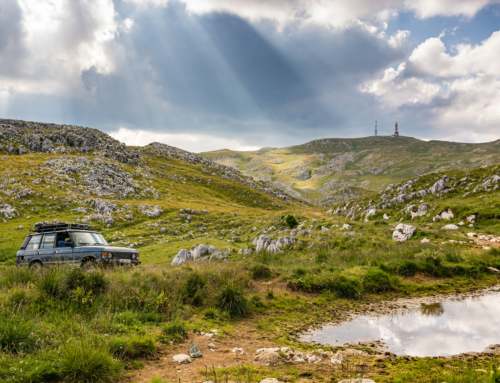
Overall, nearly 50% of Bosnia and Herzegovina is forested. Most forest areas are in the centre, east and west parts of Bosnia. Herzegovina has drier Mediterranean climate, with dominant karst topography. Northern Bosnia (Posavina) contains very fertile agricultural land along the River Sava and the corresponding area is heavily farmed. This farmland is a part of the Pannonian Plain stretching into neighboring Croatia and Serbia. The country has only 20 kilometres (12 miles) of coastline, around the town of Neum in the Herzegovina-Neretva Canton. Although the city is surrounded by Croatian peninsulas, by international law, Bosnia and Herzegovina has a right of passage to the outer sea.
Sarajevo is the capital and largest city. Other major cities are Banja Luka and Bihać in the northwest region known as Bosanska Krajina, Bijeljina and Tuzla in the northeast, Zenica in the central part of Bosnia and Mostar, the largest city in Herzegovina.
There are seven major rivers in Bosnia and Herzegovina:
- The Sava is the largest river of the country, and forms its northern natural border with Croatia. It drains 76% of the country’s territory into the Danube and then the Black Sea. Bosnia and Herzegovina is a member of the International Commission for the Protection of the Danube River (ICPDR).
- The Una, Sana and Vrbas are right tributaries of Sava river. They are in the northwestern region of Bosanska Krajina.
- The Bosna river gave its name to the country, and is the longest river fully contained within it. It stretches through central Bosnia, from its source near Sarajevo to Sava in the north.
- The Drina flows through the eastern part of Bosnia, and for the most part it forms a natural border with Serbia.
- The Neretva is the major river of Herzegovina and the only major river that flows south, into the Adriatic Sea.
Phytogeographically, Bosnia and Herzegovina belongs to the Boreal Kingdom and is shared between the Illyrian province of the Circumboreal Region and Adriatic province of the Mediterranean Region. According to the World Wide Fund for Nature, the territory of Bosnia and Herzegovina can be subdivided into three ecoregions: the Pannonian mixed forests, Dinaric Mountains mixed forests and Illyrian deciduous forests.


